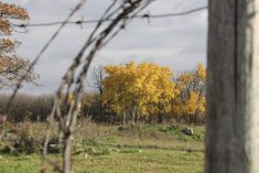
Some major waterways in agricultural Manitoba are expected to spill their banks this spring, according to the provincial infrastructure department’s first official flood outlook for the year.
Assuming normal weather conditions for the season, southern Manitobans can expect levels on the Red River south of the floodway to peak near 2011 levels, the department said.
In 2011, almost three million acres of Manitoba farmland went uncultivated due to flooding on the Assiniboine and Red Rivers and others.
If unfavourable weather conditions arise — late-season snow, spring rain and/or rapid snowmelt, for examples — the Red River may peak at levels close to its 2009 flood.
Read Also
Manitoba Crop Report: Harvest advances despite heavy rains
Despite heavy rains in much of the province, Manitoba’s harvest advanced to 86 per cent complete as of Oct. 6, 2025.
Flooding on the Red alone in 2009 impacted nearly 215,000 acres of farmland and led to closures of major roads such as Highway 75 connecting Winnipeg to Grand Forks, N.D.
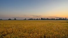
Thursday’s report also indicates the Assiniboine and Souris rivers are also expected to hit levels high enough to flood farmland and other low-lying areas.
Southern Manitobans will have to wait and see what weather the spring brings, as rain in March and April combined with a late melt could compound the flooding risk.
Ice is expected to be thicker than normal, increasing the likelihood of ice-jam flooding.
Manitoba’s major lakes are expected to remain “within their respective operating ranges” this spring, the province said, noting a low risk of overland flooding in the province’s Interlake, upper Assiniboine and Whiteshell regions.
The Saskatchewan River and Carrot River in northern Manitoba, meanwhile, are at “moderate” risk of overland flooding.
Thursday’s report follows a similar outlook released a week ago by the U.S. National Weather Service.
The U.S. agency noted a substantial risk for snowmelt-related flooding above long-term historical averages across the Red River and Devils Lake basins.
— Marlo Glass writes for MarketsFarm, a Glacier FarmMedia division specializing in grain and commodity market analysis and reporting.