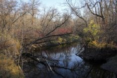
It’s a variable soil moisture picture on the Prairies as seeding season draws nearer.
The east has enough moisture — and in some cases too much. And it gets progressively drier toward the west, with portions of Alberta nearing critical condition, according to one weather watcher.
Bruce Burnett, weather and markets director for the MarketsFarm division of Glacier FarmMedia, said the soil moisture picture is better than in past years, but still concerning in some regions.
“We are a little bit better than we were last year for moisture, especially topsoil moisture, because of the way some of the winter precipitation patterns have been,” he said. “But realistically the subsoil moisture remains very short and some key growing areas, especially western parts of Saskatchewan and southern Alberta.
Read Also

Alberta harvest wrapping up: report
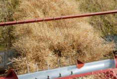
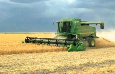
Harvest operations advanced to 96 per cent complete in Alberta as of Oct. 7, with only a few late-seeded cereal and canola fields remaining, according to the latest provincial crop report.
“That’s specifically the area I’m most concerned about,” he added.
Burnett added the Prairie winter was a relatively mild one, especially in the western half, with the coolest temperatures also seen in the east of the region.
“We didn’t have a brutal winter in terms of temperatures,” he said.
Alberta dry
Laura Richard, an agroclimate analyst with AAFC, says a long, cold winter has made soil moisture detection in Alberta difficult, thanks to extended snow cover.
Going by winter precipitation, however, southern Alberta is looking strong while the rest of the province — particularly the central, northeast and Peace regions — is going to need a spring recharge as it continues to bounce back from the 2021-22 drought.
“Generally speaking, regions south of Calgary have gotten between 60 and 115 per cent of average precipitation so those are our areas of real recovery,” she said. “The southern areas also received good fall moisture going into winter.
“Unfortunately there’s a big swath between Edmonton and Calgary as well as the northeast where they’ve only received 40 to 60 per cent of normal precipitation. That’s not dire, but given the dry conditions these areas went into winter with there’s still some concern over the soil moisture.”
The same goes for parts of the Peace, Richard said.
“Southern portions of the Peace got more precipitation but the central and northern parts were definitely in that less than 60 per cent of normal precipitation.”
If there’s any comfort for producers in drier areas, it’s the fact that spring rains are what Alberta farmers generally count on even in the best of years.
“We know for sure that it’s the rains in June and July that really determine the quality of the crops and that’s how Alberta actually gets the majority of its moisture,” Richard said.
Snowpack generally looks good in dry areas around Edmonton and the Peace. However, it can be hard to count on until it’s melted.
“Just because snow falls in one location doesn’t mean that’s where it’s going to melt and percolate through the soils,” she said.
“It depends on how quickly it melts, how much rain we get and what our temperatures are like — all of that can really affect where that moisture actually gets into the soil. So until we have that snowmelt it’s really hard to predict where the areas of greatest concern are going to wind up being.”
Saskatchewan variable
In Saskatchewan the soil moisture situation seems to be reasonable in most of the eastern part of the province, except for the extreme southeast corner, but getting drier to the west.
Matt Struthers is a crop extension specialist with the Moose Jaw office of Saskatchewan Agriculture and is editor of the province’s weekly crop report. He said south and west of his location, the moisture picture gets “a little spotty,” with areas of adequate snowfall this winter interspersed with areas that didn’t see much accumulated snowfall.
“As you move into the southwest — around Swift Current, Shaunavon and Consul — it’s a bit drier this spring, and they’re likely to need some timely spring rains,” he said.
Speaking with Glacier FarmMedia on April 11, he noted the slower start to the spring might be a positive, provided it didn’t get too late for seeding to be accomplished in a timely manner.
“Being that it’s a bit later, that may help conserve that moisture and aid germination once we get that seed into the ground,” he said. “But of course, people — including me — might be a little anxious about how long we might be delayed.”
Farming in the region is a question of managing around the variability of its climate, he said, and noted that in just the past couple season the province’s farmers have coped with significant variability. Spring 2021 was very dry. Spring of 2022 was really wet in the eastern half of the province. And this year is a late spring.
“Historically, we’ve been here before, we’ll be here again, I don’t really start to worry until July rolls around and another heat dome sets up,” he said.
Some good news accompanying the slow spring is flying under the radar, he noted — namely, that cooler weather and moist conditions are likely taking a bit out of the grasshopper population as larvae and nymphs succumb to the conditions.
“Last year this area had a big problem,” he said. “We had a dry spring, it warmed up quickly, and the grasshopper population thrived.”
The cooler weather might delay seeding, but it’s also delaying the pests, he noted — a case of Mother Nature both giving and taking away.
“I’m hoping for a lot of give this year,” he said with a chuckle.
Keystone OK
Timi Ojo echoed that soil moisture levels appear to be adequate across most of Manitoba heading into spring seeding.
“I wouldn’t expect that we would have an issue with soil moisture this year,” said Ojo, an agriculture meteorology specialist for Manitoba Agriculture.
“In most places, soils were sitting at about 80 to 100 per cent of their available water holding capacity (AWC) from the fall.”
In a typical spring, even if there hadn’t been a late-season storm and even if the ground hadn’t remained frozen longer than normal, the situation would still look pretty similar in terms of soil moisture, especially with AWC numbers where they currently sit, he said.
“Most of the precipitation received over the winter doesn’t actually have a significant impact directly on soil moisture,” Ojo explained. “The two main pathways for precipitation are either to infiltrate the soil or to flow overland. And in the spring, one of the things we see is that most of the precipitation is partitioned towards overland runoff.”
The only areas of the province that may have concerns with soil moisture are areas that were dry in the fall (areas south and west of Duck Mountain, for instance), or areas with low water holding capacity to begin with because of having sandy, coarse soils (the southwest corner of the province around Melita and Pierson). But even in those areas, Ojo said, producers shouldn’t panic.
“I wouldn’t be too worried about it,” he said. “It’s quite early; we expect to have some spring showers coming through.”
While Ojo said farmers are unlikely to see delays in seeding similar to those that emerged last year after the province was hammered with three consecutive Colorado lows, a different weather-related issue might hamper efforts to get crops established this year. With soils still frozen and below-normal temperatures projected between now and June, soil temperature could be a concern for farmers.
“We likely won’t have as much warming as we’d like,” he said. “If the soil temperature is not warming up enough, the seed is going to be in the ground for much longer, and it won’t germinate quickly,” he cautions. “Be mindful of that and watch the soil temperature at seeding depth.”
Weather watching
As always, Burnett said, it’s going to be a balancing act between soil moisture, which gives crops their start, and timely rainfall in the growing season.
“Most of the precipitation that we receive in the Prairies are in the May-June-July-August period,” he said. “If we don’t get normal precipitation during that time frame, and especially if we don’t get it at the right times, then we certainly see crops stress developing.”
Those areas with the lowest subsoil moisture levels are, unsurprisingly, at the highest risk.
“The problem with that is we have no, shall we say, capacity, to withstand severe periods of drought during the growing season,” he said. “So if you get into a dry spell in, let’s say, the first three weeks of July, then you see a lot of stress developing in the crops.”
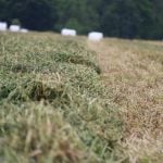
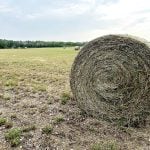
Subsoil moisture won’t protect the crops entirely, but it’s a decent buffer against the vagaries of nature, as many producers will remember from the recent years of drought in the region, Burnett said.
In the short term he’ll have his eye on southern Manitoba, particularly the Red River Valley, as it works its way through any flooding issues and the late spring.
“It’s probably going to be about another three or four weeks before some farmers get on the fields just because of how much moisture there is around,” he said.
He says he’ll also be monitoring the shifting weather patterns. The La Nina phase that’s been affecting weather has ended and been replaced by a neutral phase that’s likely to be replaced by an El Nino.
“So that means that we probably are gonna see a different weather pattern than we’ve been experiencing for the last few years,” Burnett said.
— Reporting for Glacier FarmMedia by Gord Gilmour, with files from Don Norman and Jeff Melchior.