PastureMap is grazing management software sold around the world that got its start in no small measure because of Christine Su’s lifelong struggle with food allergies.
“This drove me to try to source beef and dairy products from local farmers and ranchers that I knew, here in California. This opened my eyes to how complex the management of a cattle operation is,” she says.
She started building PastureMap in 2014 with local cattle ranchers on the California coast, to help family farms and ranches — the backbone of the food system — become more productive and profitable. Su grew up in Northern California and came to know her local farmers and ranchers through buying direct from them.
Read Also

Alberta ranch family outlasts droughts
Over the years, the Lehr family has learned a thing or two about managing the ranch through dry years
She has three degrees from Stanford, including an MSc in land use and agriculture and an MBA, and worked three years in business building software for private companies, including McKinsey and KKR Capstone. “Then I quit the business world to go work on a dairy farm as a farm hand, and also worked on some high country wool growers’ operations in New Zealand. I tried to work on as many livestock operations as I could, and fell in love with this way of life,” she says. She ended up working on farms and ranches on four continents, including California, New Zealand, and Japan.
This was good experience. On a lot of these operations most of the records were kept in notebooks or lists or maps on the barn wall. That got her wondering how a person could keep the knowledge that is accumulated by the prior generation, and share that with the next generation so it is not lost.
“That was my idea behind PastureMap, and I talked to some of the ranchers that I knew in California. I was still in graduate school at that time and was doing a graduate school project with research funding to build a forage-monitoring app to take photos and record grazing moves,” she recalls.
“It eventually became this whole livestock and forage management system. After keeping records we can start to show producers — using their own data — how their cattle perform on different pastures. We can determine if this was a factor of rainfall, or of stocking density, or some other factor,” she explains.
This is where her PastureMap app is helping producers today, and now there are 8,000 ranchers using PastureMap, 5,500 of them in North America. She also built the operations reporting platform for the largest hazelnut nursery in the world.
“The programs we build are all coming from the producers themselves. People call us every day, and our current request list is 300 features long. We don’t build anything that producers don’t ask for. We ask them to rank the features they want, and often they want to know how they can automate something that they would otherwise take a lot of time doing themselves — such as calculating stocking density or calculating how many rest days there have been in a certain field. We have built both of these features in PastureMap,” she says.
“PastureMap can do that automatically, so the rancher or farmer can spend less time using their pocket calculator or the calculator on their phone, and spend more time making the actual decisions needed. The innovations have actually all come from the producers; I just came up with a way to automate those,” says Su.
PastureMap can work offline because often where producers are using it there is no cell phone reception.
“You just download the map tiles onto your phone and you can go fully offline. You can go out in the field and take photos, do livestock move records, take notes about the stock, and leave notes about the water tank or other infrastructure. Many of the ranchers we work with have multiple team members they need to share knowledge with. If a tree falls down on a fence somewhere you can take a photo of it and add a note, and then the next person can see it on a map on their phone and go out and fix it and know where to go,” she explains.
Her company is now working with the USDA on building a soil health component for PastureMap, because there is growing interest in soil health and building soil health.
“A producer will be able to include soil test results directly on the map and soon be able to see, with grazing records, what grazing management decisions they made, and how this affects soil health on different parts of their land.”
She hopes this will also someday help increase marketing opportunities for producers who are doing direct marketing.
“There are many producers who are doing great work stewarding the land and their cattle and we want them to be able to have the data to back it up and actually show what they have been doing,” she says.
The more a person uses this technology, the more uses they generally find for it. There is a rainfall history feature, where people can put in all the rainfall events, and create a graph that charts them over time.
“Every year your PastureMap account gets smarter because you can go back and look at what you did last year, the year before, and how the rainfall was, and you can use that information to help make decisions this year.”
There are many multi-generational teams using PastureMap.
“For example, it might be the ranch owner who has been on the land for 10 or 20 years or more, and he can now map everything and show his team this information. Then the interns and the new apprentices who come onto the land can have all of this on their phones. This can really help the new trainees to understand what is going on with the landscape. Just knowing where the gates are, or the water sources can be helpful,” she explains. The new trainee can tap into a pasture and understand the history of it and management goals and grazing history on that pasture, and this can help that trainee understand more about the context of the whole ranch.
“We also work with RFIDs so any producers who have RFID can upload their entire TrueTest Excels or CSV files that they got from a weighing day, and we automatically import all of that information and update each of their animals’ weights. Every animal has a full lifetime history of all the different weight events, including health and medical notes, in case there is some need for traceability in the future,” she says.
PastureMap is also useful for contract grazers, even though they are not the land owner, because they can keep records of the cattle moves and the entire grazing history of what the animals have been on for the whole season.
“Showing the grazing history for the seasonal herd helps the contract grazer stay on the same page with either the owner of the stock or the owner of the land,” she says.
PastureMap accounts can also be shared with people off your ranch. “We protect your privacy, however, so there is no sharing with anyone unless you ask us to do it. In Canada, several people are using this information to help them get conservation grants for technology tools that improve management. In the U.S. some producers are able to get grants from the NRCS (Natural Resource Conservation Service) for doing monitoring and pasture or range improvements. Several people have gotten PastureMap with a grant,” she says.
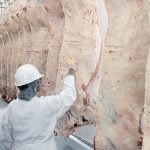
“We are also working with processors, helping them track carcass weight and share this with producers. This helps the producers understand how they can produce a higher-quality animal,” she explains.
For more details visit the PastureMap website; email [email protected]; or phone 484-727-8873.