Glacier FarmMedia | MarketsFarm – Much of Canada is set for a fall of above normal temperatures with near normal precipitation, according to the seasonal outlook released by the Weather Network on Sept. 11.
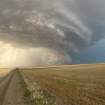
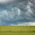
As the Weather Network projected fewer than normal fall storms through to the end of October but warned those systems that do arise “could still pack quite a punch,” the outlook said. After that, more storms are expected during the transition into winter.
The network said a key variable will be a weak La Niña developing towards November that could generate cooler than normal ocean weather temperatures in the central to southern Pacific Ocean.
Read Also
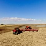
Manitoba Crop Report: Harvest nearly one-third complete
Despite varied amounts of rainfall, Manitoba’s harvest advanced to 29 per cent as of Sept. 1, 2025.
In terms of Western Canada, the jetstream has been projected to essentially divide British Columbia and Alberta from the rest of the region with fall temperatures turning cooler before those in Saskatchewan and Manitoba. As well, portions of B.C. and southern Alberta is to receive above normal precipitation.
Meanwhile the eastern half of the Prairies is expected to see near normal levels of fall precipitation, with part of Manitoba’s Interlake and east to get below normal levels. As for temperatures, Manitoba and Saskatchewan are likely to get above normal weather for most of the fall with some colder than normal days in October.
The outlooks for Ontario and Quebec highlighted a slower shift from summer to fall temperatures, with precipitation to be near to below normal. Although fewer storms are expected for both provinces, the Weather Network said a couple of systems could be quite powerful.
Atlantic Canada has been forecast to alternate between warmer than normal temperatures to those cooler than normal. While much of the region is to be drier than normal, the areas around Halifax, St. John’s and Charlottetown could be wetter than normal. Aside from tropical storms, fewer systems are in the works.