Agricultural users of Canada’s first Earth observation satellite won’t be getting new data from the unit in the near future.
The Canadian Space Agency (CSA) announced Tuesday that RADARSAT-1 has entered into “safe mode,” a semi-dormant state to conserve energy, after it “experienced a technical anomaly” on March 29.
Entering safe mode buys the CSA’s operations team the time needed to “investigate and assess any necessary remedial action,” the agency said.
While said investigation is ongoing, the agency said, “expectations of a full recovery are low.”
Read Also

Pulse Weekly: SPG looks back at harvest, ahead to trade
Saskatchewan Pulse Growers executive director Carl Potts said this year’s harvest had strong yields as the organization now works on international trade.
In the meantime, the satellite’s government and commercial users have been told no new orders for imagery are being accepted, but requests for archival images “will continue to be processed.”
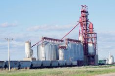
Developed and operated by the CSA and launched from California in 1995, RADARSAT-1 began transmitting information in February 1996, monitoring environmental changes and Earth’s natural resources. It uses a synthetic aperture radar instrument able to take images of Earth day and night, in all weather, through cloud cover, smoke and haze.
The satellite was originally conceived to work for just five years, but has “far surpassed its design lifetime,” providing information to users in agriculture as well as in cartography, ice studies and observations, hydrology, oceanography, forestry and disaster management.
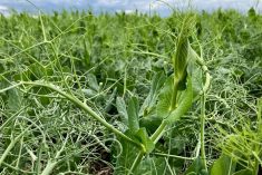
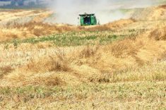
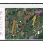
RADARSAT imagery has allowed agricultural planners to examine and assess crop characteristics and planting practices and better forecast crop yields.
Under favourable conditions, the CSA has said, soil characteristics such as moisture content and surface roughness could be identified to help gauge crop conditions, land’s susceptibility to erosion and its irrigation needs.
Information systems companies such as MDA (MacDonald, Dettwiler and Associates) have used imagery from RADARSAT-1, among other sources, to produce more timely ag-related products.
“Not only are the crop information needs distributed spatially, crop information is temporal-dependent, and usually requires numerous images that span the cropping cycle,” MDA has said. “The spatial and temporal information needs for crop monitoring lend themselves to the use of satellite imagery, specifically the imagery from radar and optical satellites.”
The CSA also emphasized Tuesday that RADARSAT-1’s situation “does not impact the security of Canadian borders, coasts and northern territories.”
RADARSAT-2, Canada’s next-generation commercial radar satellite launched in 2007, “continues to provide critical, high-quality data,” the agency said.
MDA’s Richmond, B.C. Canadian head office, for one, said Tuesday the impact of RADARSAT-1 not functioning is “not significant to MDA’s business.”