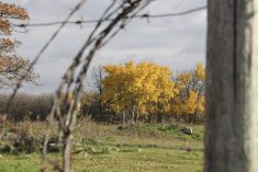
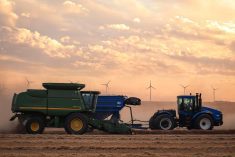
Glacier FarmMedia—There’s a good chance western Canadian farmers and ranchers will see rain in April and May to get crops started and grass growing, says a U.S. based weather scientist.
It is only a forecast, says Matt Makens with Makens Weather based in Colorado, but the El Nino weather pattern is fizzling out and the La Niña weather pattern is phasing in.
“A lot depends on how quickly that transition occurs,” says Makens, who recently spoke to the Alberta Beef Industry Conference in Calgary.
Read Also

Prairie forecast: A temperature rollercoaster and the possibility of snow
Prairie forecast covering October 8 to 15, 2025. The Prairies may be in for a prolonged battle between warm and cold air before winter sets in. This could bring lots of rain or snow.
“But indications are that the transition is moving quickly, which means the La Niña effect will bring moisture and cooler temperatures earlier.”
That means the Canadian Prairies will likely see rain in April and May, and if the transition slows, it could delay that moisture until June and July. Makens said things are shaping up for prairie moisture early in the spring and summer, turning drier toward August and September.
Makens provides weather consulting services to CanFax, CattleFax, the National Cattleman’s Beef Association and many producers across North America. He noted that after the sun, El Niño and La Niña are the second biggest factors driving global weather patterns.
El Niño is a weather pattern that occurs in the Pacific Ocean, usually every three to five years. Winds warm surface water from the equator and move east toward Central and South America. The southern part of Alaska and the Pacific Northwest (including Western Canada) tend to be warmer and drier than average, whereas the central and southern regions of the U.S. tend to be wetter and cooler than average.
La Niña has the opposite effect. During La Niña events, trade winds are stronger, pushing more warm water toward Asia. Off the west coast of the Americas, upwelling increases, bringing cold, nutrient-rich water to the surface.
These cold waters in the Pacific push the jet stream northward. This tends to cause drought in the southern United States and heavy rains and flooding in the Pacific Northwest and Canada.
During a La Niña year, winter temperatures are warmer than normal in the south and cooler than normal in the north.
Makens notes the difference been El Niño and La Niña ocean temperatures is only one degree Celsius.
“In most conditions, and certainly in this conference centre, if the temperature changed one degree most of us wouldn’t notice,” says Makens. “But in the Pacific Ocean, if the water temperature warms half a degree, that can launch the El Niño weather pattern and if it cools half a degree, that launches the La Niña weather pattern.”
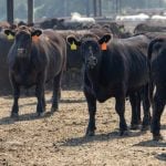
El Niño, which on average influences Canadian weather for up to 18 months, “generally is not good news for western Canadian beef producers,” says Makens, because it usually means dry conditions for Canada.
However, it is generally good news for the North American beef industry because it brings moisture to the major beef producing states of Texas, Oklahoma and New Mexico.
When the weather pattern switches to La Niña, it brings cooler winds and temperatures from Alaska and the Aleutian Islands into Western Canada — snow to mountains in British Columbia and, depending on the strength, includes moisture to the Prairies as well.
Looking ahead, Makens says his spring forecast for March through May suggests as El Niño fizzles out and La Niña moves in, there will be moisture for the Prairies. He’s optimistic for April and May rain.
For the summer forecast, June through August when La Niña settles in, the moisture outlook across Western Canada doesn’t look too bad and it will likely be somewhat cooler.
For September through November, he expects about 88 percent of the La Niña effect will be over Western Canada, with colder temperatures and moisture generally favourable for B.C. and the central Prairies.
For winter 2024-25, he is forecasting a cold winter with about average precipitation.
Makens noted a couple of wild cards. One is the 2024 wildfire season and its severity. A bad season that produces a lot of smoke will add to the cooling trend.
Another wildcard was an underwater volcanic eruption near the Polynesian Kingdom of Tonga in the Pacific Ocean in January 2022, which blasted 50 million acre-feet of water into the atmosphere. It will take two or three years for that moisture to dissipate and in the meantime, it can have a warming effect.
Makens is forecasting that the cooler trend of La Niña will affect Canadian weather for the next two to three years.