Interesting weather pattern setting up across the Prairies during this forecast period. Well, maybe “interesting” isn’t the right word; “boring” might be a better one.
What I mean by “interesting” is just how quickly we swung from a warm fall pattern to a cool winter pattern. Low temperatures across the Prairies over the last week of October ranged from around -10 C in southern Manitoba to colder than -20 C in part of Alberta.
Along with the cold air came snow — in some areas, significant amounts, with patchy areas of five to 10 cm in Alberta and Saskatchewan and some areas of Manitoba seeing upward of 20 cm. While not all areas of the agricultural Prairies obtained snow cover, enough are covered for me to say winter has started. The question is, will this be a false start to winter?
Read Also

Pulse Weekly: SaskPulse optimistic despite input, crop price concerns
SaskPulse executive director Carl Potts is optimistic ahead of the planting season despite lower crop prices and the war in Iran.
The weather models look like most of this forecast period will be dominated by cool high pressure, making for the earlier-mentioned boring forecast. Two large areas of low pressure are controlling our weather: one spinning over northern Hudson Bay, the second over the Gulf of Alaska. The spin around the Hudson Bay low is allowing for cool arctic air to be pulled southeastward but the overall pattern over the Arctic has the really cold air bottled up. While we will be cool, it does not look like there will be any bone-chilling temperatures.
The Gulf of Alaska low will try to spin off bits of energy into the Prairies during this period, but the consistent high pressure in place across the region will keep any of these systems on the weak side.
Alberta
If we want to call this winter, then Alberta will see nice early-winter weather. There will be a bit of a battle between milder air trying to move northeastward ahead of the Gulf of Alaska low and the colder air pushing southward behind the Hudson Bay low. Southern regions look to stay on the mild side, with daytime highs in the low to mid-single digits and overnight lows falling to around -5 C. Temperatures will drop by a few degrees as you move into central regions and a few more degrees in northern regions.
Precipitation looks to be minimal, with some small chances of showers or flurries across most regions over the weekend as some energy from the gulf low tries to move eastward.
Saskatchewan
A couple of sub-arctic highs will drop southeastward through northern Saskatchewan into north-central Manitoba during this period. Between these highs the weather models show a weak area of low pressure moving through the province over the weekend. Expect sunny to partly cloudy skies over this forecast period with a little more cloud and the odd flurry over the weekend. Daytime highs will be running between 0 and -4 C, with overnight lows falling into the -7 to -12 C range. Told you it was boring.
Manitoba
Much the same forecast as Saskatchewan: a couple of sub-arctic highs cutting through the northern half of the province, with a weak low moving through southern and central regions over the weekend. Skies will be sunny to partly cloudy with maybe more clouds than sun over the weekend. There could be a few flurries or maybe some light snow as the low crosses the regions and interacts with open water in the Interlake region. Daytime highs will be similar to Saskatchewan, ranging from 0 to -4 C with overnight lows in the -6 to -10 C range. Could see a few colder overnight lows in regions that have heavier snow cover, and clear skies overnight.
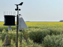
— Daniel Bezte is a teacher by profession with a B.A. (Hon.) in geography, specializing in climatology from the University of Winnipeg. He operates a computerized weather station near Birds Hill Park, Man. Contact him via email with your questions and comments.