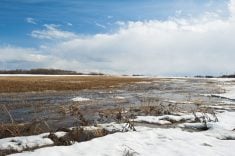
Well, last week was warmer, and overall the weather models did a good job with the forecast. The part that that didn’t play out quite as expected was the storm system that impacted the eastern Prairies on Sunday and Monday. While the models showed potential for snow in that period, they missed the strength and positioning of the low, which resulted in more snow than initially expected.
To start this forecast period, the strong area of low pressure that tracked through the eastern Prairies is now over Hudson Bay. The rotation around this low is opening the door for a strong, very cold Arctic high to build southwards into the eastern Prairies. This looks to bring some of the coldest temperatures so far this winter to eastern Saskatchewan and western Manitoba. The good news is that it doesn’t look like the cold air will stick around long.
Read Also
Prairie forecast: No real signs of winter yet
Forecast issued November 12, covering Nov. 12 to 19, 2025 Highlights Developing conditions suggest above-average temperatures, limited precipitation and light…
Meanwhile, over western Saskatchewan and Alberta, seasonable mild temperatures are expected as an upper ridge of high pressure begins to build ahead of an area of low pressure approaching the southern coast of B.C. This upper ridge will bring mild temperatures to much of Alberta during the first half of this forecast period. The milder air will slowly transition eastwards as we work towards the end of the week.
The B.C. low is then forecasted to track across the central Prairies over the weekend and into the early part of next week. The southerly flow ahead of it will keep mild air over the southern half of the Prairies. The weather models don’t show this low becoming too strong, so no significant snowfall is expected.
Looking further ahead, the weather models show mostly mild temperatures to continue through to Christmas, with no signs of any big storm systems. In fact, some of the weather models are showing a strong upper ridge developing over the western Prairies in the days leading up to Christmas. This could push daytime highs well above freezing.
Alberta
Mild and quiet weather conditions pretty much sums up the forecast for this region. We start with a slowly building ridge of high pressure. This will bring sunny to partly cloudy skies along with daytime highs in the -5 to 0 C range over southern regions and -8 to -5 C range over central and more northern regions. These temperatures will moderate as we work towards the weekend with daytime highs in the -2 to +4 C range in the south and -5 to 0 C range in the north.
Western regions could see some light snow on Wednesday. After that, the weather models show only a small chance of some light snow over northern region as we move into the weekend. This is a result of the energy moving inland form the Pacific low. It looks like there will be a slight cool-down as the low passes with temperatures returning to more average values for this time of year.
Looking into the third week of December, leading up to the holiday break, the weather models show a huge and complex storm system building into the Gulf of Alaska. This, in turn, will help to develop more upper-level ridging over Alberta. This means more quiet and warm weather, which looks to last right through to Christmas. Should this play out as currently forecasted, I wouldn’t be surprised to see daytime highs on Christmas Eve and Christmas Day in the low to mid single digits.
Saskatchewan and Manitoba
It is going to be a cold start to this forecast period as Arctic high pressure builds in behind the storm system that hit parts of these regions earlier this week. This high is being squeezed between a building ridge of high pressure to the west and the large low over Hudson Bay. This will keep the heart of the cold air over eastern Saskatchewan and western Manitoba.
Expect daytime high to only be in the -24 to -28 C range with overnight lows in the -30 to -35 C range with coldest temperatures over regions where the winds are light. Areas on each side of the Arctic high will not be as cold, but winds will be a little higher, bringing colder wind-chill values.
Luckily, these cold temperatures shouldn’t stick around for long. A building upper ridge over the western Prairies, combined with an area of low pressure off the B.C. coast that’s forecasted to move inland late this week, will help pull milder air northwards. Expect a prolonged two to three-day warming trend staring late Thursday or early Friday. This will see temperatures moderate back toward near, or even above seasonal values by the weekend. Expect daytime highs by Saturday to be in the -6 to -4 C range with overnight lows falling to around -12 C.
The Pacific low, forecasted to move across the central Prairies, may bring a quick shot of snow on Sunday or Monday, but the current forecast keeps most snow north of most forecast regions. As usual at this time of the year, system like this bear watching. Looking further ahead, the weather models show another chance of a light snow around next Wednesday. This is ahead of some milder air pushing eastwards thanks to another upper ridge forecasted to build over Alberta. Should this materialize, expect mild temperatures to last right through to Christmas.
Stay tuned to next week forecast for a detailed holiday outlook!
— Daniel Bezte is a teacher by profession with a B.A. (Hon.) in geography, specializing in climatology from the University of Winnipeg. He operates a computerized weather station near Birds Hill Park, Man. Contact him via email with your questions and comments.


