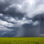
Considering the complexity and uncertainty in last week’s forecast, the weather models did a surprisingly good job. The western U.S. trough spawned several areas of low pressure that eventually drifted north or northeastwards. These brought several rounds of showers, thunderstorms and general rain to Alberta and parts of Saskatchewan.
Meanwhile, Manitoba stayed on the warm side of these lows. The strong subsidence and northern push of warm air saw several records broken as temperatures flirted with all-time highs for the month of May.
Across the eastern Prairies, all eyes are on the breakdown of the western trough and the resulting ejection of the final area of low pressure. The weather models are still trying to get a handle on this feature.
Read Also

Manitoba Crop Report: Harvest advances despite heavy rains
Despite heavy rains in much of the province, Manitoba’s harvest advanced to 86 per cent complete as of Oct. 6, 2025.
The latest model runs show the main low moving into Minnesota before quickly sliding off to the east. This would bring less rainfall and warmer conditions. This is in contrast with early model runs, which showed the low stalling over southern Manitoba and tapping into very cold air—which would’ve meant significant rainfall and even some late season wet snow.
Over Saskatchewan and Alberta it looks like the next week will see typical mid-May weather with a few chances of showers, especially over Alberta.
Alberta
This region will see a mix of sun and clouds and seasonable temperature during most of this forecast period.
We start with an area of low pressure exiting northern regions. This low will drag a cold front southwards to trigger afternoon showers and maybe the odd thundershower over northern and central regions. For the long weekend, a weak area of low pressure will slide southwards on Friday. This will bring a few showers—mostly to western and southern regions. Behind this low it looks like weak ridging will build in, which will mean sunny to partly cloudy skies and daytime highs in the upper teens to low twenties.
The forecast for after the long weekend is a bit of mixed bag. Several weak areas of low-pressure are forecast to track across the province. The timing of each low is uncertain at this point but expect most days to see a mix of sun and clouds and a good chance of showers, especially over southern and western regions. Currently it looks like Saturday and Monday will see the best chance of showers.
Temperatures are expected to be seasonable with daytime highs in the south in the 16 to 20 C range due to greater cloud cover. More northern regions likely see highs in the 18 to 22 C range thanks to clearer skies.
Saskatchewan and Manitoba
This looks to be a cool and unsettled period for most of these two provinces. A large area of low pressure looks set to develop and push northeast through the Dakotas and Minnesota on Thursday and Friday. Clouds and moisture from this low will begin pushing northwards into eastern Saskatchewan during the day on Wednesday and into Manitoba by Wednesday evening.
Widespread showers and thundershowers will develop by Wednesday evening. The eastern half of Saskatchewan should see most of the rain on Thursday while the southern half of Manitoba will see it on Friday. The low is forecast to pull off to the east early on Saturday. Cold air will be pulled southwards behind the departing low and there is a small chance of a bit of wet snow mixing turning into lingering showers early Saturday morning across central Manitoba.
Temperatures to start the long weekend will be cool with daytime highs in the 7 to 10 C range and overnight lows flirting with the freezing mark. Skies should begin clearing on Saturday. Sunday will likely be the nicest day with plenty of sunshine and highs in the mid-teens. We may sneak in another nice day on Monday before a second area of low-pressure lifts northeastward out of the central U.S. This will bring another round of showers and rain beginning on Tuesday.


