The weather models did a fairly good job with the big weather picture last week. The timing of the systems was off by a bit, but given the active nature of our current weather pattern, that is not surprising. For this forecast period we are going to see the active weather crank up a notch as an area of low pressure and an associated deep upper trough moves on shore from the Pacific.
As I mentioned in last weeks weather article, March and April can see some of the biggest snowstorms of the year. While I don’t think this one will be one for the record books, there’s the potential for some wintery weather across the Prairies between now and the end of the weekend.
Read Also
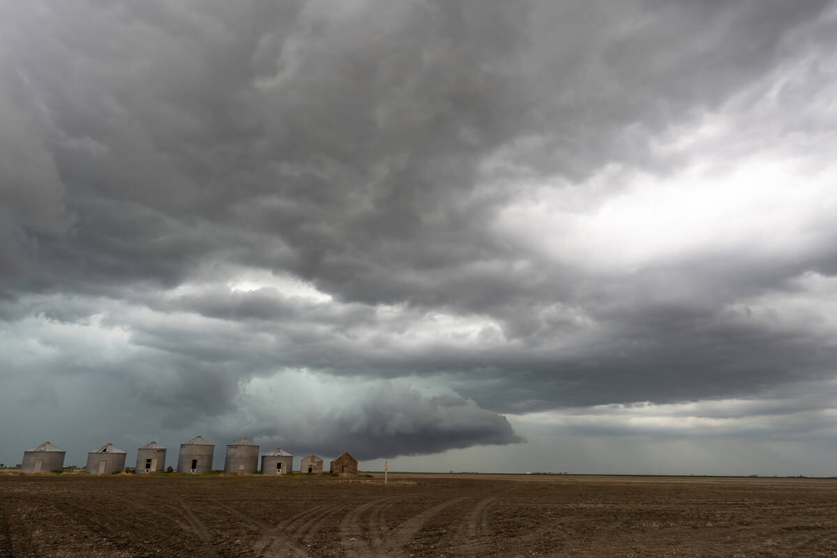
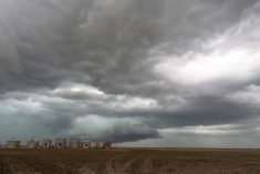
Prairie forecast: Storm systems bring wintery mix
Several storm systems are setting up across the Prairies with potential for rain, freezing rain and snow. Forecast issued April 15, 2026, covering April 15 to 22, 2026
The Pacific storm system is forecasted to move into the northwestern U.S. on Wednesday and will be sitting around the Montana/Wyoming border by Thursday. As the upper trough catches up, the low will deepen and drop southwards into Colorado. The models are showing this storm becoming very strong with a forecasted central pressure of around 975 mb. This will contribute to some very strong winds around the low. The low is forecasted to eject northeastwards towards Northwestern Ontario on Saturday and to bring all sort of nasty weather to the eastern Prairies.
Alberta and Saskatchewan will also be impacted by this system as moisture associated with the initial Pacific low pushes in. The low looks to bring widespread snowfall to central regions of both provinces on Thursday and Friday.
Once the system passes, the weather pattern looks to quiet down a little bit. The next Pacific low is forecasted to move in late on Sunday. It brings a chance of light snow to southern Alberta on Monday before it slides south of the border on Tuesday and Wednesday. Except for some milder temperatures ahead of the Colorado low, temperatures look to be below average during this forecast period.
Alberta
As stated above, an area of low pressure will move in from the Pacific late on Wednesday, slide along the Canada/U.S. border on Thursday, and then drop southeast into Colorado. Snow will begin to develop across western and central regions beginning on Thursday morning. They could last until late Friday due to a weak trough hanging back behind the main low as it drops southeastwards. Current indications are that these regions could see between 5 and 10 cm of snow.
The weekend should see sunny to partly-cloudy skies as weak high pressure tries to build in. This will keep temperatures on the cool side with daytime high forecasted to be in the -5 C range and overnight lows falling to around -12 C. Regions that see clearing skies may see overnight lows dropping to around -15 to -17 C.
Another area of low pressure is forecasted to move in from the Pacific and impact southern regions on Monday. Expect cloudy skies across the south with occasional periods of light snow. At this point, snow amounts look to be light. North central and northern regions will continue to see partly cloudy skies with slightly below average temperatures. Skies across the south should begin to clear out on Tuesday and Wednesday.
Saskatchewan
As the Colorado low develops, mild air will be pushed northwards. This should allow daytime highs to be in the 2 to 5 C range on Wednesday and Thursday across southern Saskatchewan. Snow from the low is forecasted to develop over central regions on Thursday and could last until Friday before tapering off. The weather models are showing widespread amounts of between 5 and 10 cm with some locations in danger of seeing 15 cm before it is all done. There is a chance of some showers along the southern edge of the precipitation on Thursday before changing to all snow on Friday. Southern regions look to miss out on most of the snow.
Once this system pushes off to the east on Saturday, skies should become partly cloudy for the remainder of this forecast period as weak Arctic high pressure tries to drop southwards. Temperatures look to be on the cool side with daytime highs in the -4 to 0 C range with overnight lows falling to around -12 C.
Manitoba
It’s a tough forecast for Manitoba, at least for the first half of this forecast period. While all the weather models are in good agreement on this weekend’s Colorado low, they are all over the place when it comes to what happens once it lifts northeastwards. The reliable CFS model is currently showing rain over eastern Manitoba beginning sometime on Friday with snow over western regions. The Canadian model is showing most of the moisture missing Manitoba to the east. All I can say is keep an eye on the forecast as thing will become clearer by late Thursday or early Friday.
The low should be out of the region by Sunday, which will allow for clearing skies and cooler temperatures as Arctic high pressure tries to build southwards behind the low. Expect sunny to partly cloudy skies to start the week with daytime highs in the -2 to -5 C range and overnight lows falling to around -12 C, colder in regions that see clear skies overnight.