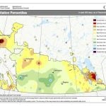
The weather models did a pretty good job with last weeks forecast, even predicting the snow over the eastern Prairies on Tuesday. The models were hinting at a return to above average temperatures for this forecast period, and they are still mostly sticking to this.
Things are looking not too bad for those who want to see snow or deep freeze temperatures. As we start this forecast period, a strong area of Arctic high pressure is dropping southeastwards over the eastern Prairies behind the strong area of low pressure that zipped through on Tuesday. Over the western Prairies, the weather models show a strong ridge of high pressure building over B.C. which is expected to transition eastwards.
Read Also

U.S. grains: Soybeans gain on lackluster harvest sales, lower yield outlook
Chicago | Reuters — U.S. soybean futures rose for a second straight day on Wednesday on expectations that U.S. harvest…
This weather pattern should bring well-above-average temperatures to most of Alberta, with the above-average temperatures spreading eastwards towards the weekend. As the warm air pushes eastwards, it will slowly slump southward meaning the southern parts of the Prairies will experience the warmest temperatures with slightly cooler temperatures over more central regions.
The warm air looks as if it will get pushed southwards by early next week, but the weather models are only showing a weak push of cold air building in behind the warm air. With the transition from warmer to colder conditions there is the chance of some snow, especially over southern Saskatchewan and Manitoba early next week. It doesn’t look like it will be a big snow maker, and as usual that is a long way off, and things can change.
Alberta
This region could see a lot of the recent snow melt away. The weather models are showing a strong upper ridge building over the regions. This ridge will bring sunny-to-partly-cloudy skies and well above-average temperatures to start this forecast period. Expect daytime highs over southern regions to be pushing 8 to 10 C by Friday with central and northern regions seeing highs in the – to 4 C range.
The upper ridge is forecasted to collapse on Sunday as it slides to the east. Colder air will work is way southwards and drop daytime highs into the -5 to -10 C range across the province. There could be a little snow over southern regions as the cold air pushes in, but at the time of writing this the weather models are not showing any significant accumulations.
After a brief cool down, the weather models are showing milder air pushing it way back into the Alberta by Tuesday or Wednesday with daytime highs once again moving back into above zero values.
Saskatchewan and Manitoba
This region will see a much colder day on Wednesday as Arctic high pressure drops southwards behind the area of low pressure that cut trough central Saskatchewan and Manitoba on Tuesday. Expect daytime highs to either stay steady or drop during the day, ending up around -18 C by the evening. It also looks to be quite windy with winds of 40 gusting to 60 kph or more expected over eastern Saskatchewan and most of southern and central Manitoba. Fortunately, these cold temperatures are only expected to last a day or two before milder air pushes eastwards thanks to a ridge of high pressure building over B.C. and Alberta.
This upper ridge will push eastwards late in the week and bring much milder temperatures. Saskatchewan will see the warmest temperatures with daytime highs by Friday or Saturday into the 0 to 5 C range. As the warm air pushes eastwards, it will slowly slide to the south. This means while Manitoba will see warmer temperatures, by the time the warm air reaches the province, the mildest temperatures will be to the south. Nevertheless, expect daytime highs on Saturday and Sunday to be in the -2 to +3 C range.
As the warm air slides to the south late in the weekend, cooler air will be pushing in from the north. The weather models are showing an area of low pressure developing along this boundary over the northern U.S. which may bring some measurable snow to southern Saskatchewan and Manitoba early next week. Confidence in this feature is low but as usual, it bears watching.
On a positive note, the extended mid-range forecast, which forecasts out to December 20th is not showing any significant outbreak of cold air. So far December is living up to the prediction of warmer than average. The question is—will it still end up being snowier?
— Daniel Bezte is a teacher by profession with a B.A. (Hon.) in geography, specializing in climatology from the University of Winnipeg. He operates a computerized weather station near Birds Hill Park, Man. Contact him via email with your questions and comments.