As we head into a new year, it’s looking like this could be the last mild forecast period before a switch to a more typical winter weather pattern.
As usual, there is always a fair bit of uncertainty in forecasts beyond seven or so days, but we all knew that at some point we’d see some cold wintery weather move in.
For the next seven days, the forecast is looking fairly straight forward–sunny, warm and dry. So, let’s dive into this short and simple forecast by taking a look at the big picture.
Read Also

Mixed year for hail claims across Prairies: CCHA
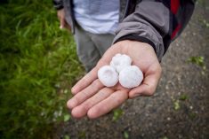
The 2025 crop year was an average year for hail across the Canadian Prairies, with overall claim numbers down slightly compared to last year, reported the Canadian Crop Hail Association (CCHA).
We start off with a broad ridge of high pressure stretching from the northwestern U.S. across much of the Canadian prairies. This ridge will bring light winds and mostly clear skies for Alberta and Saskatchewan. Manitoba will have to deal with clouds and low-level moisture left behind from the system that clipped this region over the Christmas period. This ridge will slowly weaken and drop back down to the south by Friday only to be replaced by a new strengthening ridge over Alberta over the weekend.
As this ridge builds over Alberta, a deepening trough of low pressure over eastern North America will allow an area of Arctic high pressure to drop southwards into the eastern prairies by the weekend. This will bring more seasonable temperatures to start the new year for that region. It doesn’t look like this high and the associated colder weather will stick around long, as the Alberta ridge is forecasted to begin breaking down and sliding to the east around New Years Day. This should bring one more shot of mild weather to eastern regions.
Alberta
‘Sunny and mild’ sums up the forecast for this region. Upper ridging is forecasted to be in place for much of this forecast period. Daytime highs are forecasted to be in the +4 to +8 C range with even some low teens possible, especially over southern regions. Overnight lows will also be mild with most nights only seeing temperatures dropping down to around -5 C. As the ridging finally breaks down early next week, expect to see temperatures begin to cool with daytime highs falling below zero by Tuesday or Wednesday of next week.
Saskatchewan
This region is expected to see very similar weather to Alberta with a couple of minor differences. Temperatures will be a little cooler with daytime highs forecasted to be in the 0 to +4 C range and overnight lows falling to around -10 C. It also looks like there will be a short, one-day cool down around New Year Eve as arctic high pressure drops southwards into Manitoba. There will then be a rebound in temperatures for one or two days as ridging builds back into the region. Colder air is forecasted to move in later in the week.
Manitoba
It’s a little bit of a tougher forecast for this region as it starts with lots of low clouds and low-level moisture trapped under the upper ridge. With ridging forecasted to remain in place and a weak winter sun, these clouds will have a hard time breaking down or getting moved out. It looks like there will some sunshine moving in by Friday.
Temperatures will also be cooler across this region with daytime highs in the -2 to -5 C range and overnight lows falling to around -10 C, with areas that clear out a few degrees colder.
It looks like slightly colder weather will move in around New Years Eve as arctic high pressure drops quickly through. Expect daytime highs to be in the -7 to -10 C range with overnight lows around -15 C. Temperatures will warm a little bit to start the new year as ridging tries to re-establish itself across the region. This looks to be short lived as a northwesterly flow develops behind a deepening trough of low pressure digging over eastern North America. This may help open the door for the first real outbreak of cold weather so far this winter.


