The weather pattern that brought some record heat to the eastern Prairies, and some significant rains to parts of Alberta, looks like it will be undergoing a bit of change during this forecast period.
The overall flow across the Prairies appears as though it will become predominantly northwesterly as an upper low sets up over northern Hudson Bay. The counterclockwise flow around this upper low will create a general northwesterly flow across our region and will allow for arctic high pressure to slowly slide southeastward during this forecast period.
Read Also

Pulse Weekly: SaskPulse optimistic despite input, crop price concerns
SaskPulse executive director Carl Potts is optimistic ahead of the planting season despite lower crop prices and the war in Iran.
While this is setting up, most of the southern and central Prairies will be under the influence of a weak but broad area of high pressure, which will bring sunny to partly cloudy skies along with average temperatures for this time of the year. Luckily for us, the arctic high will take nearly a week to drop southward, which will allow it to warm significantly. So, while it doesn’t look like we will see cold temperatures in this feature, it looks like most regions will see a break from hot and humid conditions, at least for a while.
Alberta
This region has an interesting pattern developing. High pressure situated over the eastern Prairies will help to develop a southerly flow at the surface, while at the same time aloft, there will be a northwesterly flow. Skies should be mainly sunny for the most part, but with warming surface temperatures and colder air aloft, there will be chances for thundershowers/storms nearly every afternoon. Best chances for storms look to be over central and northern regions. Daytime highs look to be in the low 20s until the weekend, with overnight lows falling to around 10 C.
Over the weekend the arctic high will slide by to the east. This will begin to allow some upper-level ridging to start developing across the province. This feature will start to suppress the thundershower/storm activity and allow temperatures to warm. Daytime highs early in the last week of June look to warm into the mid- to upper 20s, with overnight lows falling to around 15 C.
Saskatchewan
This region will be high and dry to start off this forecast period as the broad but weak area of high pressure dominates the region. Expect plenty of sunshine and warm temperatures, with dewpoints looking to be much lower, meaning nice comfortable temperatures during the day and overnight. Expect daytime highs around the 25 C mark with overnight lows falling to about 12 to 14 C in most regions.
Over the weekend the arctic high will begin pushing southeastward across the northern part of the province. As this arctic high pushes southward, showers and thundershower may develop ahead of this system. Best chances for any rainfall will to be on Sunday or Monday afternoon. Temperatures do not look like they will cool down much, with only a few degrees’ drop on Sunday and Monday before rebounding back up around into the mid- to upper 20s to end the forecast period.
Manitoba
Manitoba will also start off this forecast period with weak high pressure in place. This should bring sunny to partly cloudy skies to most regions on Thursday and Friday along with nice seasonable temperatures. Over the weekend the big question is whether the area of high pressure in place will be strong enough to keep a small but fairly strong area of low pressure south of the border. Currently the U.S. and European weather models keep all the precipitation south of the border, with only the Canadian model showing precipitation across our region. The latest Canada model run is trending southward with the precipitation so I think southern regions will see cloudy to partly cloudy skies over the weekend along with temperatures in the low to mid-20s. Central regions should be partly cloudy to mostly sunny with similar temperatures. I will keep an eye on this and issue an update if needed.
The arctic high dropping southeastward may bring a slight cooldown to start the last week of June, but with its current path expected to bring it to around James Bay by Tuesday or Wednesday, the impact from this high looks to be minimal. So, under the peak seasonal sunshine, expect nice warm temperatures with highs in the 25 to 28 C range with overnight lows falling into the 14 to 16 C range.
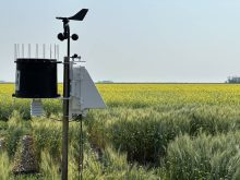
— Daniel Bezte is a teacher by profession with a B.A. (Hon.) in geography, specializing in climatology from the University of Winnipeg. He operates a computerized weather station near Birds Hill Park, Man. Contact him via email with your questions and comments.