There has been a little bit of a shift in the overall weather pattern according to the latest weather model runs. The arctic high is dropping east-southeast as expected and will be around James Bay by the middle of this week. Along the southern boundary of the arctic air, the weather models show an area of low pressure developing in north-central Saskatchewan late on Monday. This low will then slowly drift to the southeast across central and southern Manitoba from late Tuesday through to Thursday.
Over Alberta, this low not bring any significant weather. Instead, the province will see a building upper ridge which should bring sunny and dry conditions along with warm temperatures. Expect daytime highs to be in the mid-20s with overnight lows in the 12 to 15 C range.
Read Also

Pulse Weekly: SaskPulse optimistic despite input, crop price concerns
SaskPulse executive director Carl Potts is optimistic ahead of the planting season despite lower crop prices and the war in Iran.
In Saskatchewan, central and northern regions will see scattered thundershowers on Monday and Tuesday afternoon, with things quieting down by Wednesday as the low pulls off to the east. Temperatures will be seasonable with highs in the mid- to upper 20s.
Manitoba will see unsettled weather possibly develop by late Monday. As the Saskatchewan low drifts to the southeast, starting on Tuesday this region will see chances of thundershowers every afternoon and evening right through until Thursday. Manitoba will see similar temperatures as Saskatchewan.
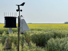
— Daniel Bezte is a teacher by profession with a B.A. (Hon.) in geography, specializing in climatology from the University of Winnipeg. He operates a computerized weather station near Birds Hill Park, Man. Contact him via email with your questions and comments.