Most of last week’s forecast played out fairly close to what the weather models predicted, except for the last couple days.
The weather models showed a ridge of high-pressure rebuilding across the Prairies by the mid-week and bringing a return to warm temperatures. This was after a brief cool down early in the week thanks to an area of low pressure that zipped across the Prairies on Sunday and Monday. Well, that low intensified more than originally forecast and then stalled over eastern Hudson Bay.
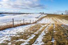
This is where we start this forecast period. A large, deep area of low pressure is spinning over eastern Hudson Bay. Weak high pressure stretches across the northern part of the U.S. and into the southern Prairies. The strong counterclockwise rotation around the Hudson Bay low is pushing plenty of cool air southwards across the Prairies. Most regions have a good chance of frost early in this forecast period.
Read Also
Dryness, drought likely to persist says forecaster
As winter approaches, the dry conditions and drought across much of the Canadian Prairies and the United States Plains will likely persist, said Drew Lerner, meteorologist with World Weather Inc. in Overland Park, Kan.
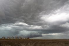
The weather models show low pressure coming in off the Pacific on Friday, racing across the Prairies and exiting Manitoba by Sunday morning. This low will boost to temperatures on Friday and Saturday and could bring the odd scattered shower. The velocity of the system looks to prevent any kind of cool down behind the low.
To start next week, the weather models show a building ridge of high pressure across the Prairies that should bring plenty of mid-fall sunshine and seasonable warm temperatures – but we’ve heard that before.
Alberta
A chilly start to this forecast period as strong north to northwesterly winds push cool air southwards. Central and northern regions will likely see overnight lows below zero on Thursday morning. The Peace River regions could see flurries on Wednesday. Further south, temperatures look to be a couple of degrees warmer. This should keep overnight lows above freezing, but frost can’t be totally ruled out.
On Friday, low pressure is forecasted to move in off the Pacific and quickly cut through central and northern regions. It looks like this system will only bring clouds on Friday with maybe one or two very light showers. Temperatures will warm a bit ahead of this system over southern and central regions. Daytime highs are forecasted to be in the mid to upper teens with overnight lows falling to around 5 C. There doesn’t look to be a push of colder air behind this system on Saturday or Sunday, so expect similar temperatures.
The weather models then show a ridge of high pressure building over the southern and central Prairies starting on Monday. This ridge should bring clear skies and warming temperatures with daytime highs pushing twenty degrees and overnight lows falling into the 7 to 10 C range.
Saskatchewan and Manitoba
These regions will start with a cool north to northwesterly flow thanks to the Hudson Bay low. Skies should be clear to partly cloudy on Wednesday and Thursday. There’s only a slight chance of some showers on Wednesday thanks to a weak impulse tracking through. Daytime highs are forecasted to be in the low teens with overnight lows likely fall below zero on both Thursday and Friday morning, especially over regions that clear out.
On Friday, daytime highs look to rebound to the mid to upper teens with overnight lows likely staying above freezing. This warmup results from an area of low pressure that’s forecast to quickly track from west to east across central Saskatchewan on Friday and through Manitoba on Saturday. The low shouldn’t bring anything more than clouds to Saskatchewan, but as it moves into Manitoba on Saturday, the models show it tapping into some moisture. This could lead to showers. Thanks to the speed of this system, rainfall amounts from this system look to be light.
Once this low passes by, the rest of the forecast period should see mainly clear skies along with slowly warming temperatures. This is due to a ridge of high pressure that’s forecasted to build across the southern and central Prairies next week. Expect daytime highs to warm back towards the twenty-degree mark by Monday or Tuesday with overnight lows falling into 3 to 7 C range.
— Daniel Bezte is a teacher by profession with a B.A. (Hon.) in geography, specializing in climatology from the University of Winnipeg. He operates a computerized weather station near Birds Hill Park, Man. Contact him via email with your questions and comments.